SkyVector Flight Planning
SkyVector is a popular aviation flight planning and mapping platform that allows pilots and remote pilots to view sectional charts, airports, airspace, navigation data, and weather overlays. It is commonly used to improve airspace awareness and assist with safe flight planning operations.
Visit SkyVector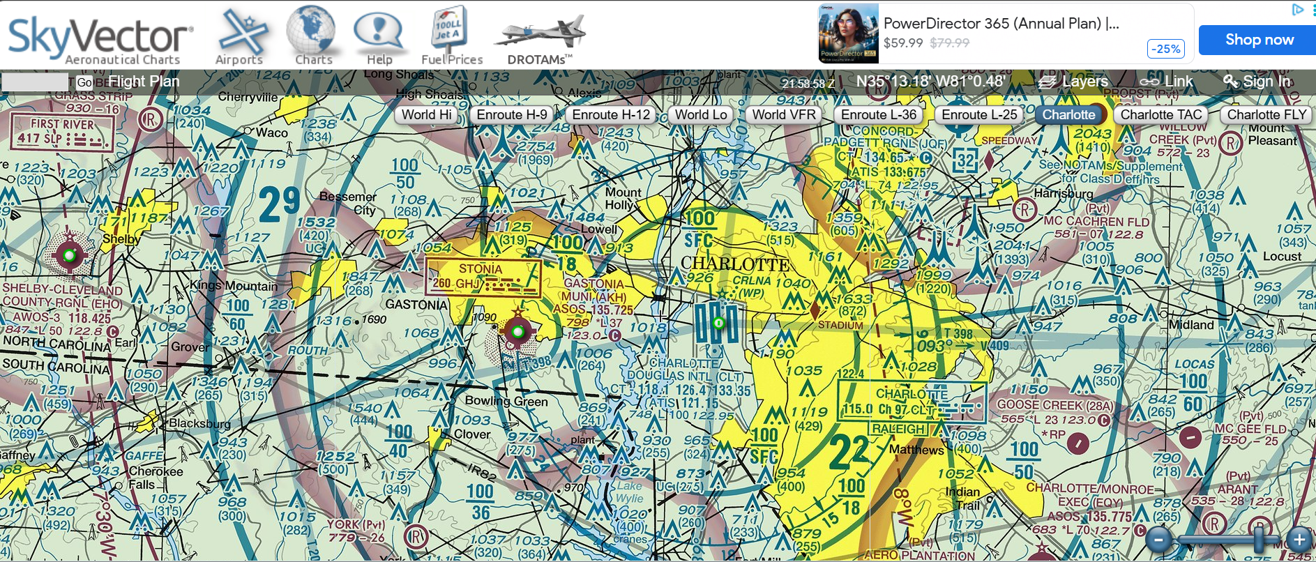
Understanding UAS Facility Maps
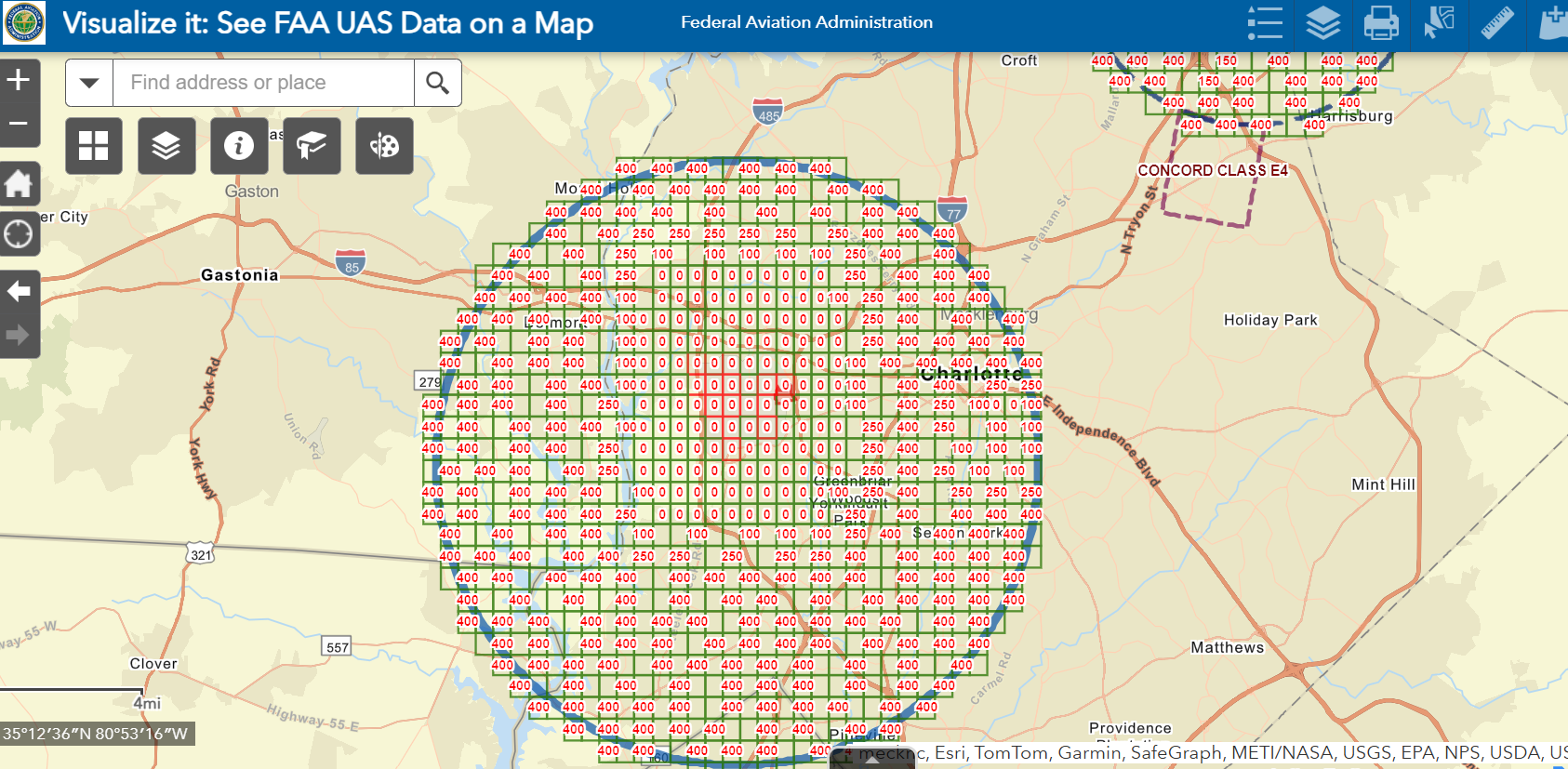
UAS Facility Maps show the maximum altitudes around airports where the FAA may approve Part 107 drone operations in controlled airspace without additional safety analysis. These maps are helpful when planning flights near airports and preparing LAANC or FAA DroneZone airspace authorization requests.
For Part 107 pilots, these maps are a practical planning resource. They help identify where approvals may be faster and what altitude limits may apply near airports.
View FAA UAS Facility Maps