Commercial Real Estate Aerial Media & Site Documentation
NC Drone Co helps commercial real estate professionals market, document, and evaluate properties with professional aerial photography, cinematic video, mapping, 3D visuals, and inspection support. From retail centers and warehouses to hotels, development sites, and mixed-use properties, drone media helps buyers, tenants, investors, and stakeholders understand the full property.
Commercial Property Visuals Can Show
- Property size, layout, access, and visibility
- Parking, traffic flow, entrances, and road frontage
- Nearby roads, landmarks, retailers, and amenities
- Roof, exterior, drainage, and maintenance concerns
- Construction progress and development potential
- Marketing visuals for listings and investor presentations
Make Commercial Property Easier to Understand
Commercial buyers and tenants need context. Aerial media shows the building, site layout, parking, access, surrounding businesses, nearby infrastructure, and development potential in a way ground-level photos cannot.
Sales & Marketing
High-quality aerial photos, video, and labeled visuals help commercial listings stand out online and give buyers a stronger first impression.
Site Analysis
Aerial maps and overview imagery help teams evaluate access, site layout, parking, traffic flow, land use, nearby infrastructure, and expansion potential.
Property Management
Drone imagery can support roof, exterior, drainage, erosion, landscaping, storm damage, and maintenance documentation over time.
Commercial Real Estate Drone Services
Services can be customized for brokers, property owners, developers, investors, property managers, lenders, contractors, and marketing teams.
Aerial Photography
- High-resolution listing photos
- Building and site overview images
- Parking, access, and road frontage visuals
- Images for websites, brochures, and presentations
Cinematic Video
- Listing videos and property flyovers
- Reveal shots and orbitals
- Drive-up and access footage
- Social media and investor presentation clips
Property Callouts
- Text labels and branded overlays
- Nearby landmarks and road names
- Parking, entrances, and traffic flow
- Tenant, outparcel, and amenity highlights
Mapping & 3D Visuals
- Orthomosaic maps
- Site overview maps
- 3D models when appropriate
- Development and planning visuals
Inspection Support
- Roof and exterior documentation
- Storm and before/after imagery
- Drainage, erosion, and access review
- Maintenance and condition records
Construction Progress
- Recurring site updates
- Development documentation
- Contractor and owner reports
- Closeout and portfolio visuals
Best Fit Property Types
Commercial real estate drone media is especially useful when location, visibility, parking, access, site layout, or surrounding development helps sell the property.
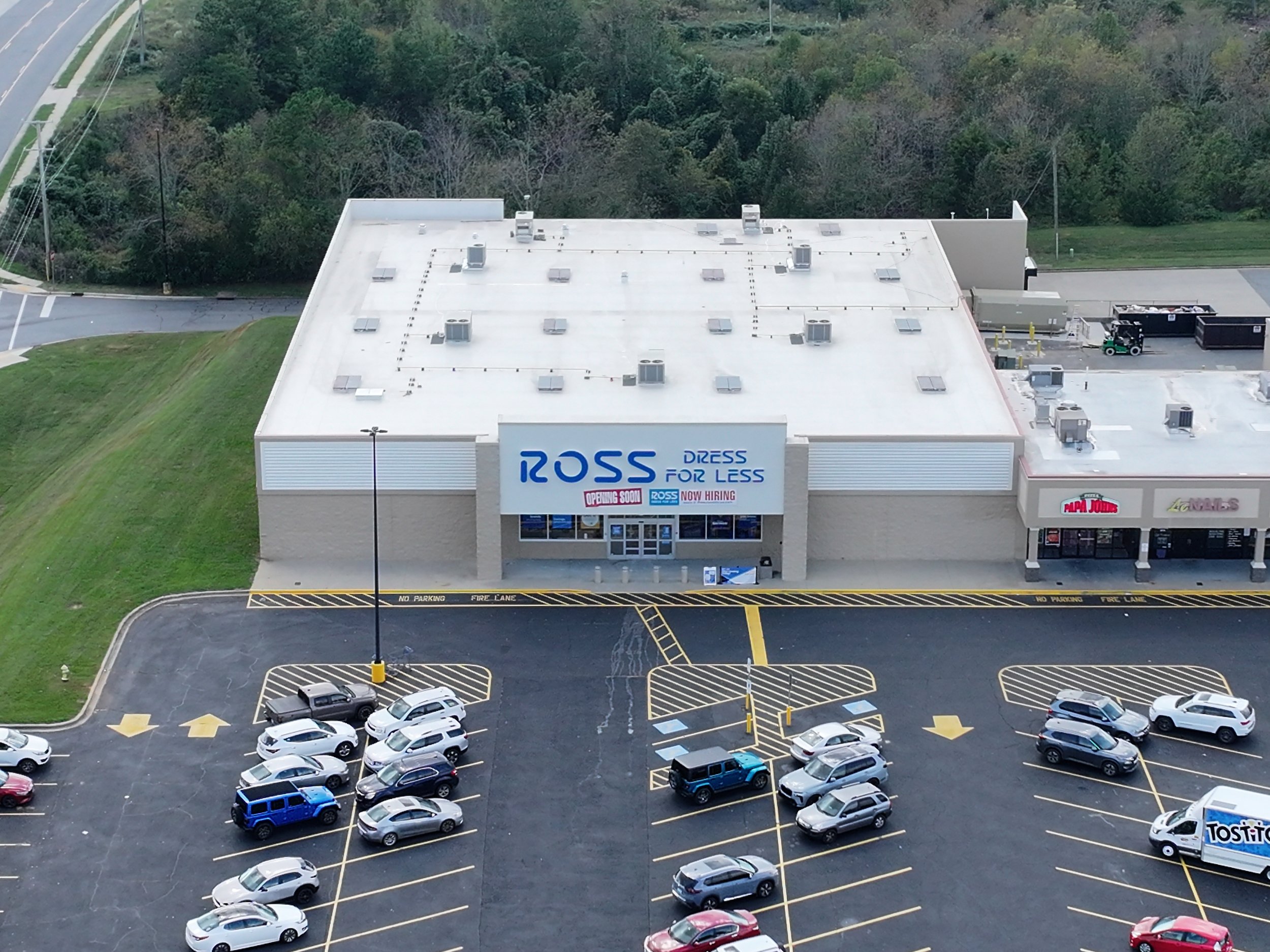
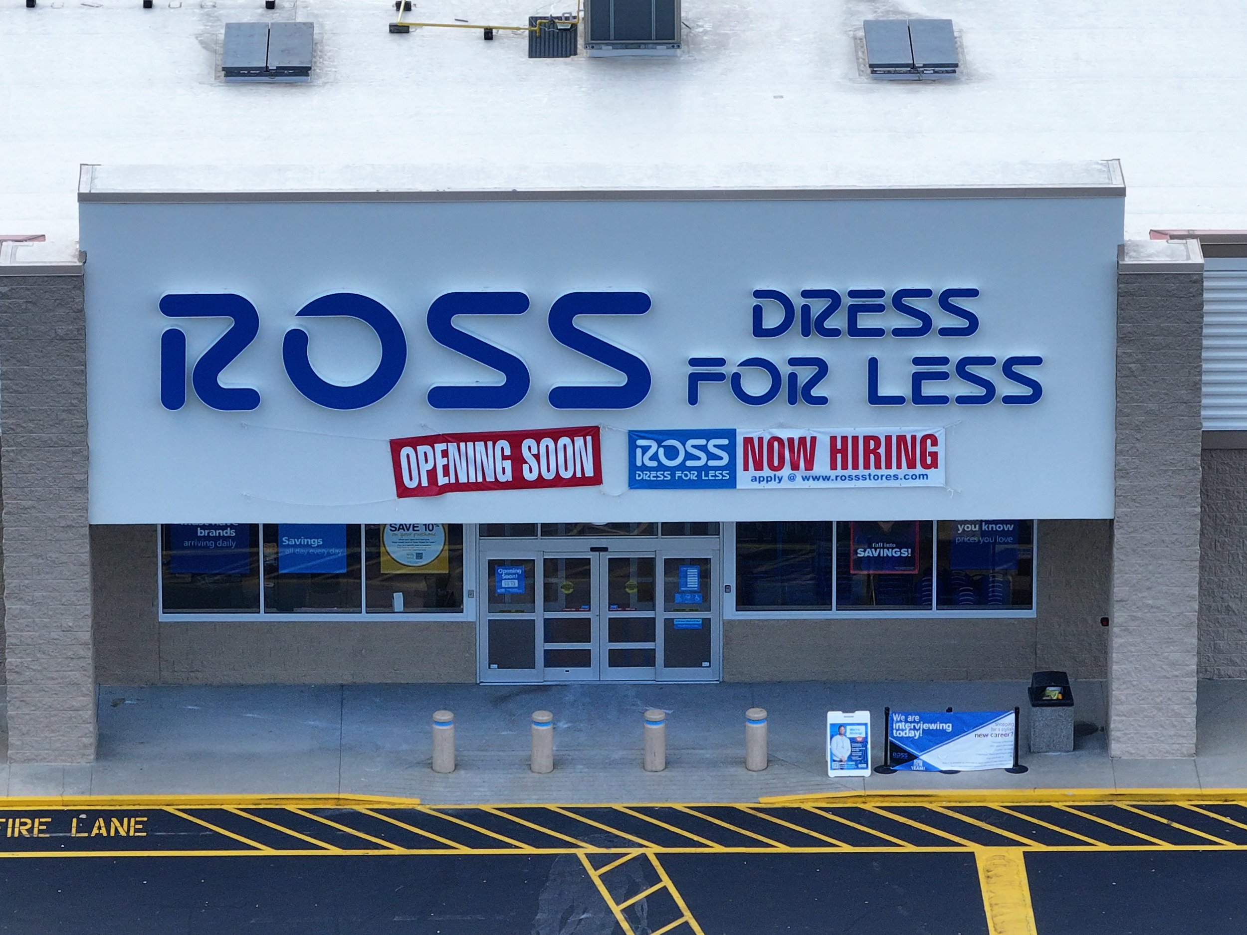
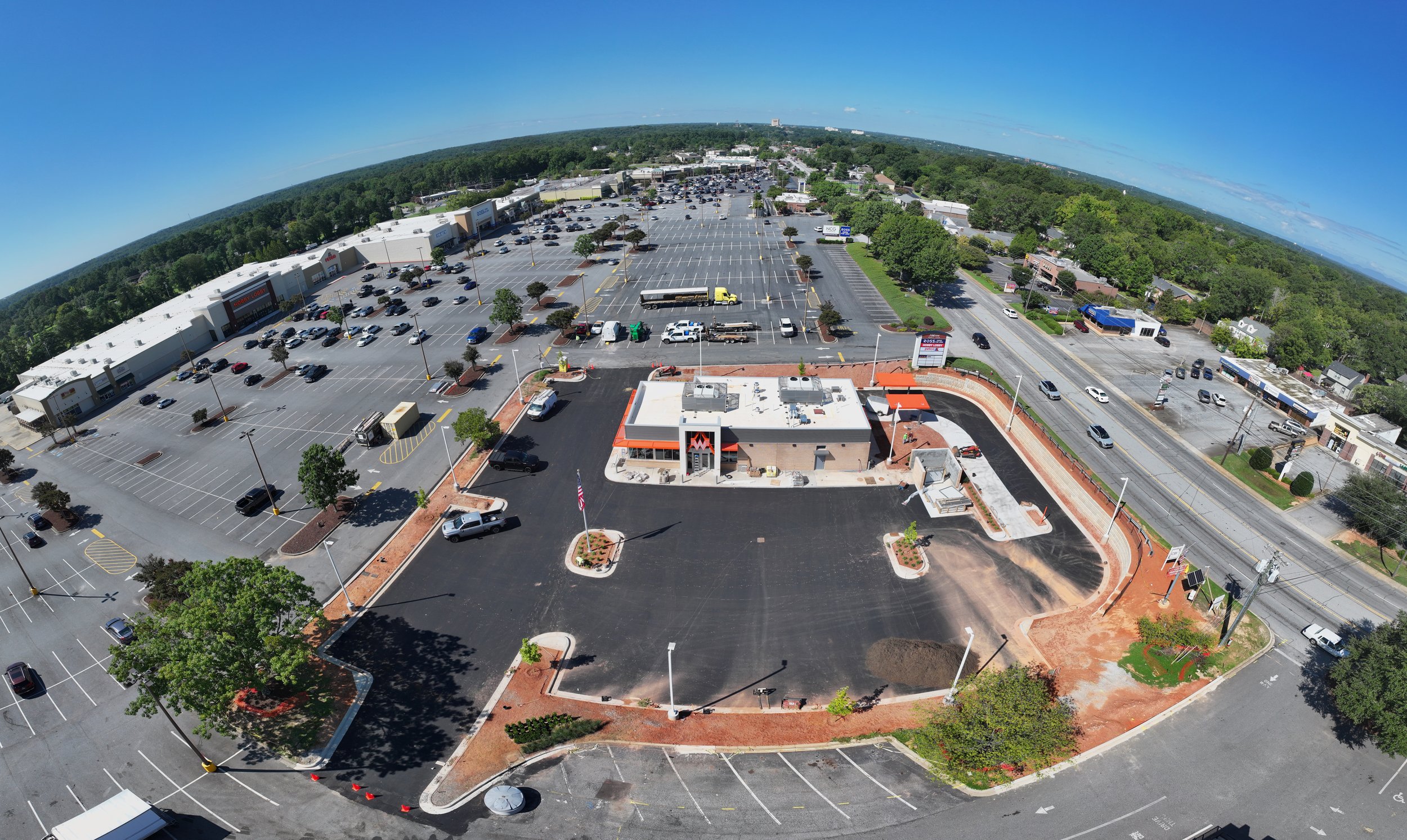
Retail & Shopping Centers
Show tenant mix, parking, entrances, nearby roads, outparcels, traffic exposure, and surrounding commercial activity.
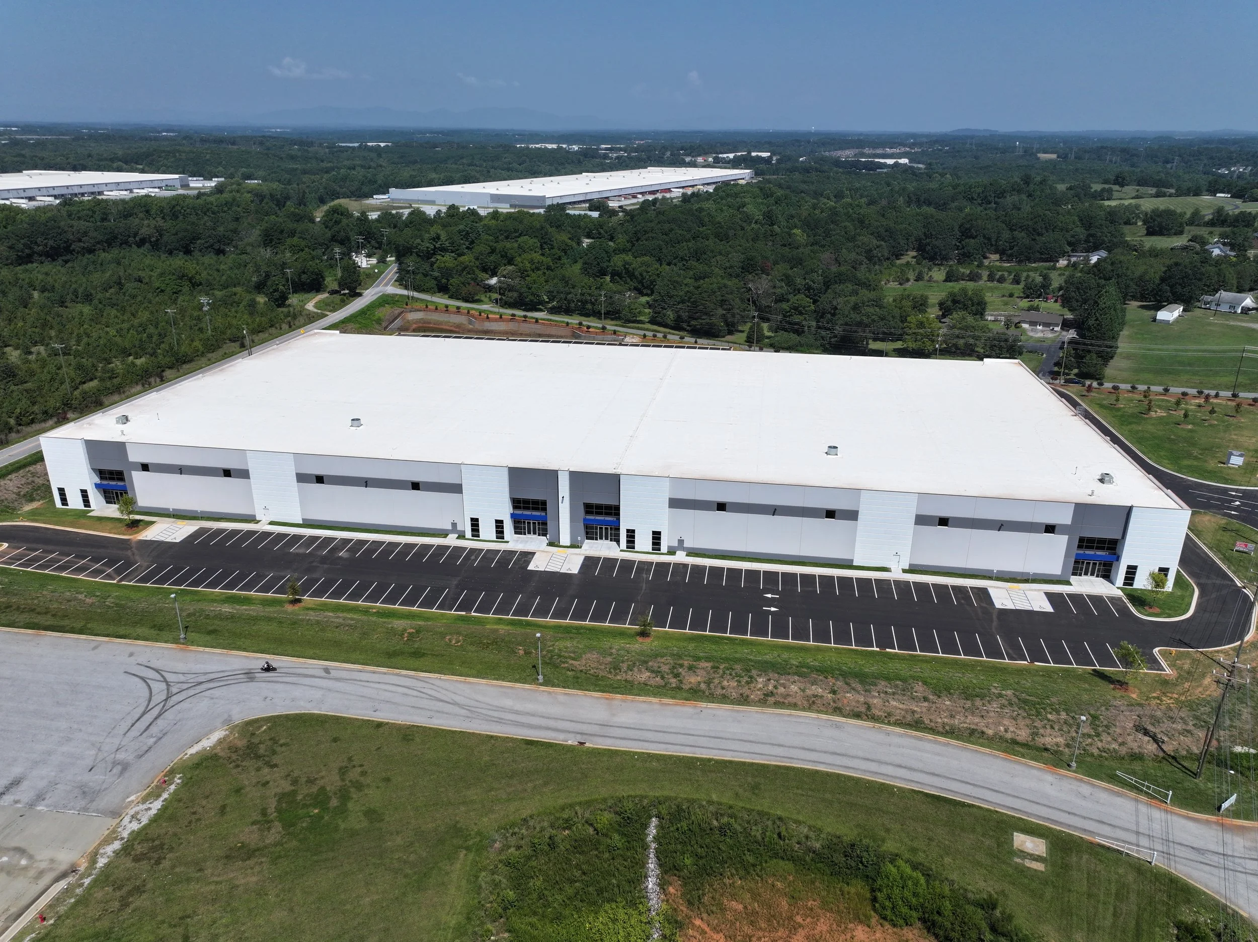
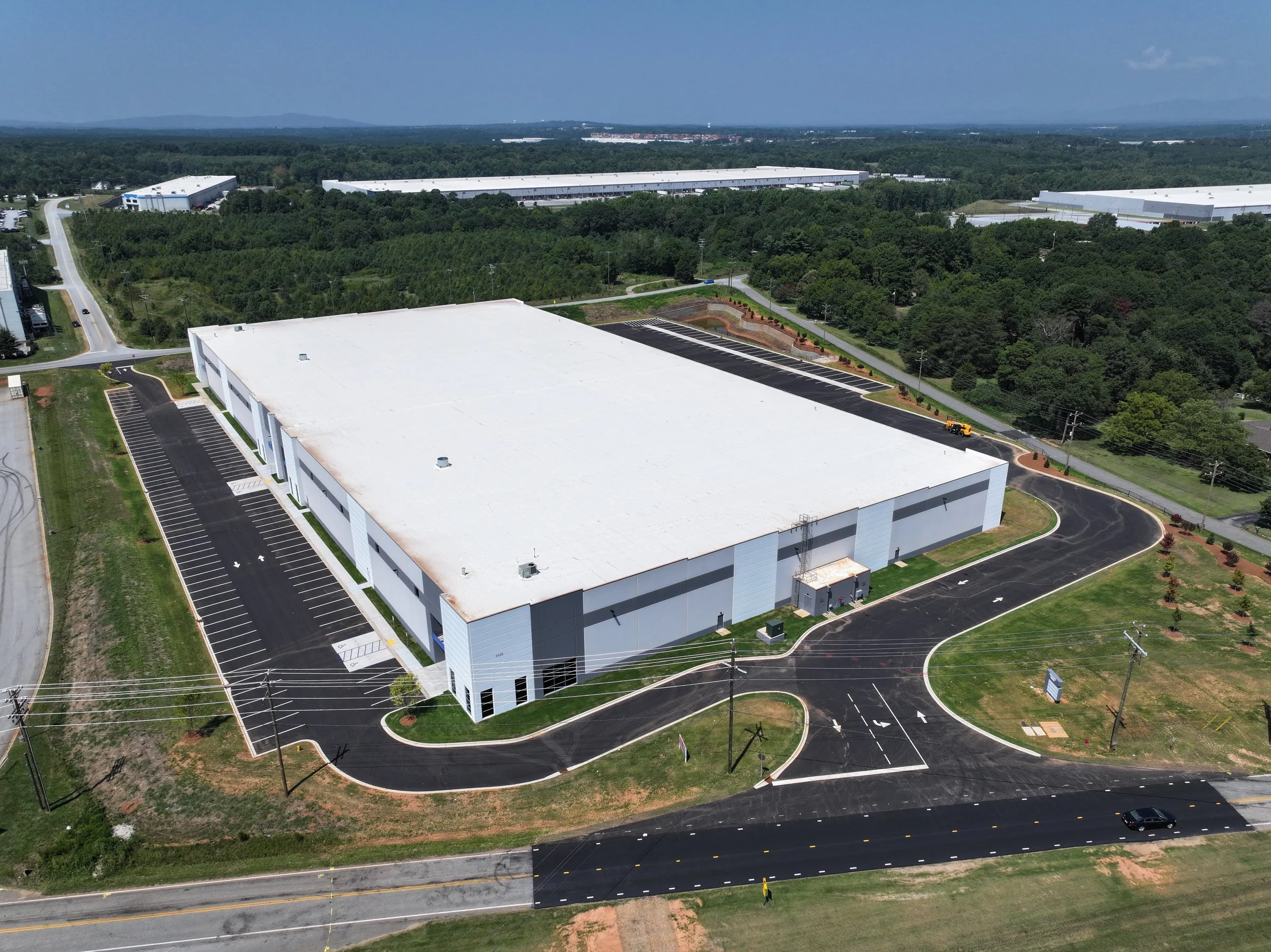
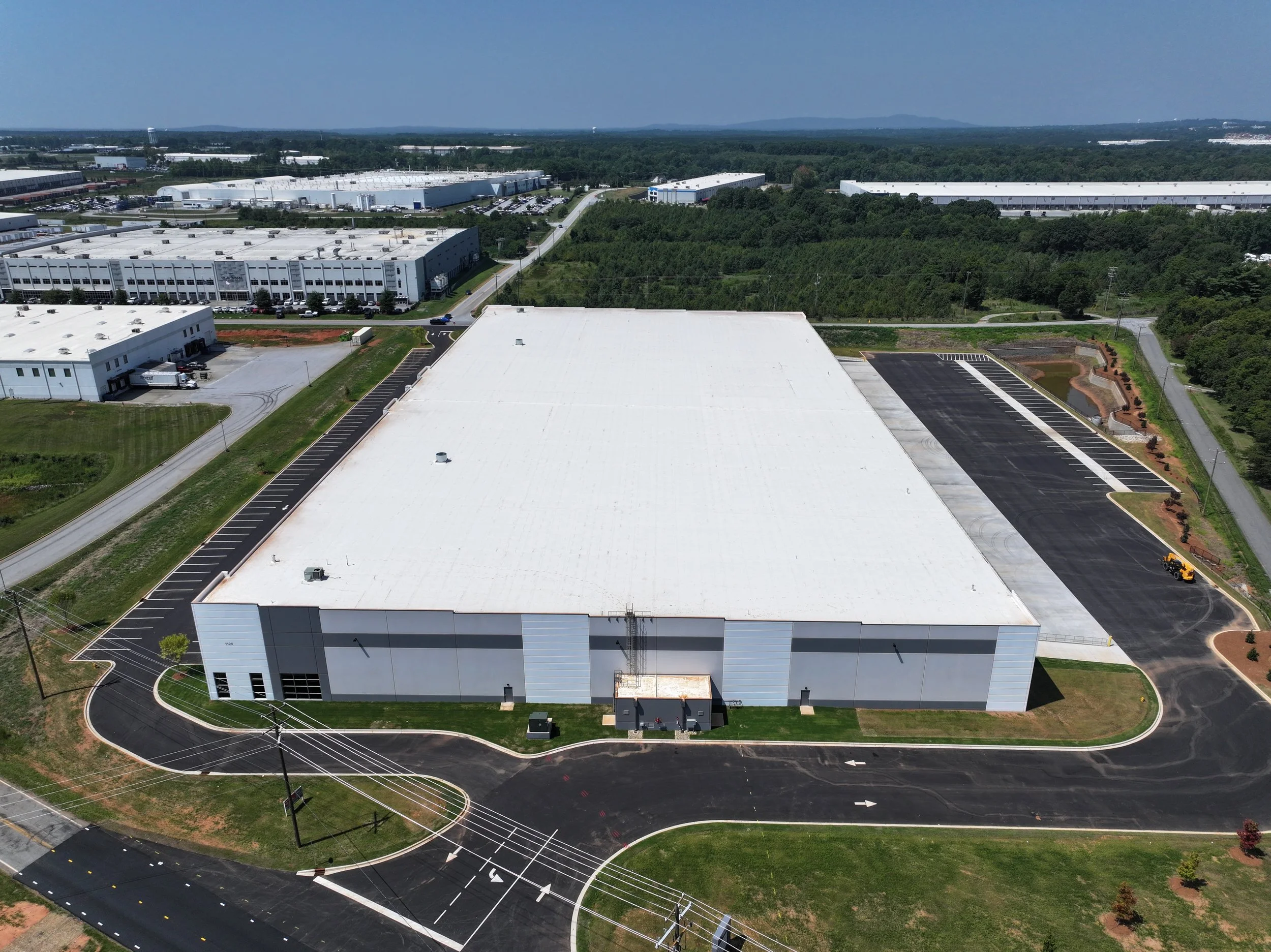
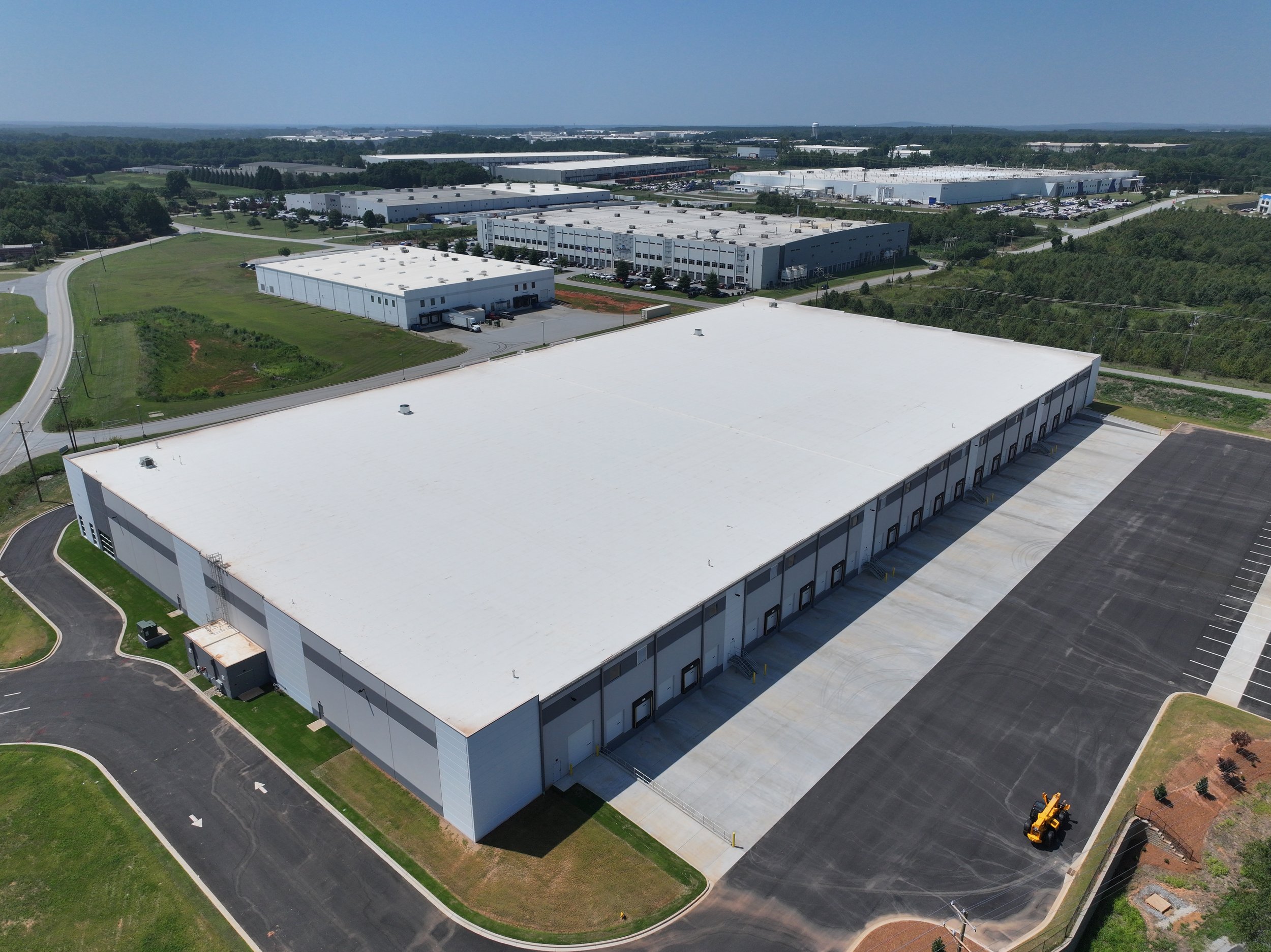
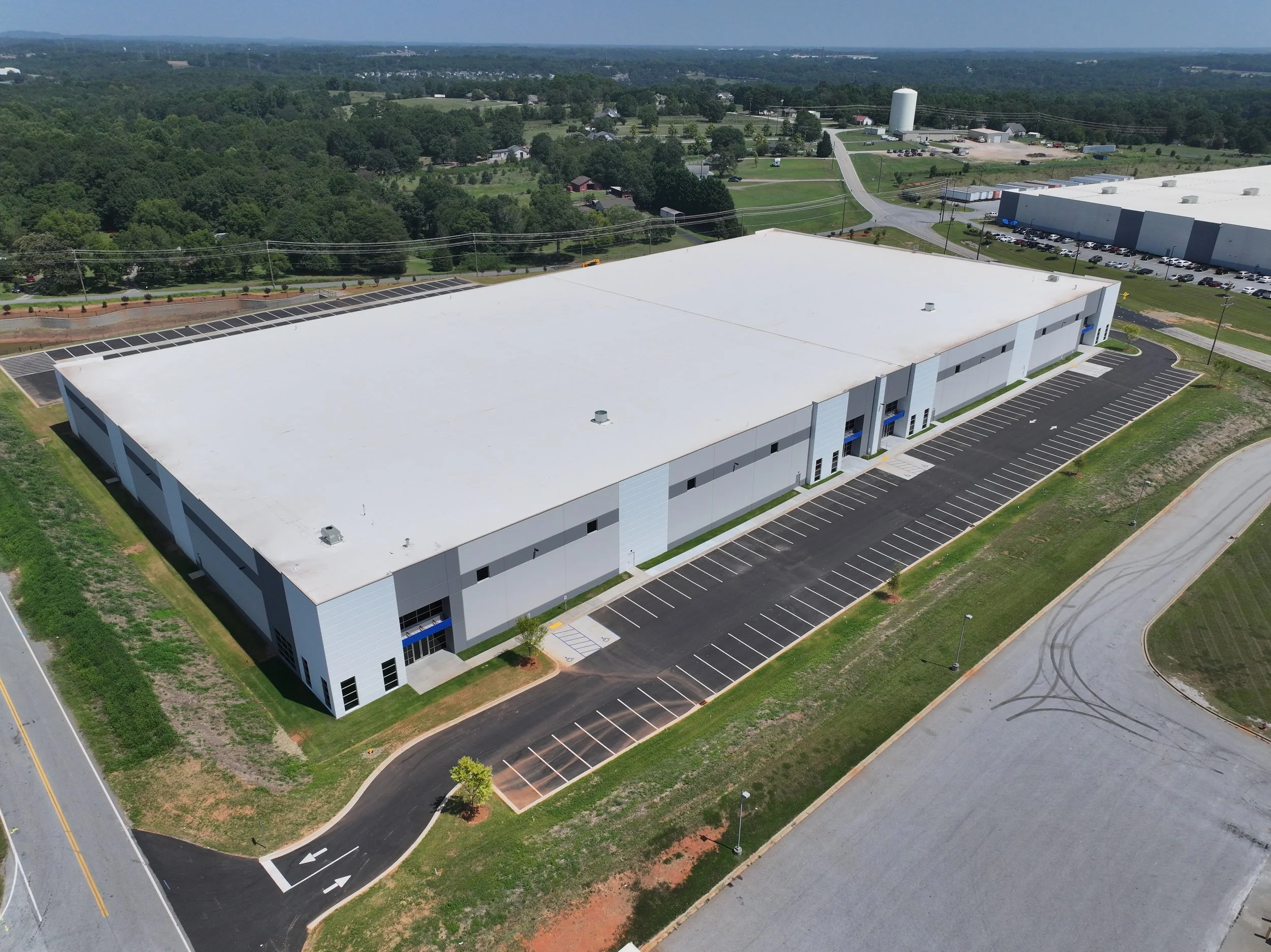
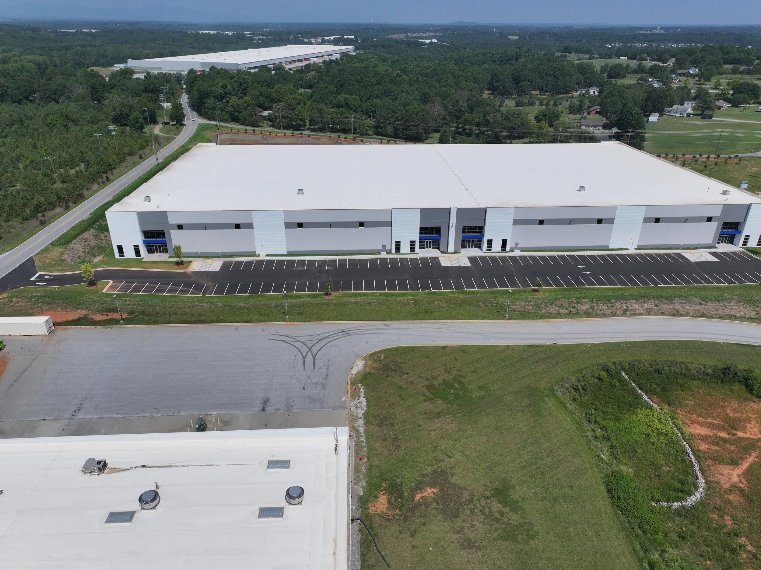
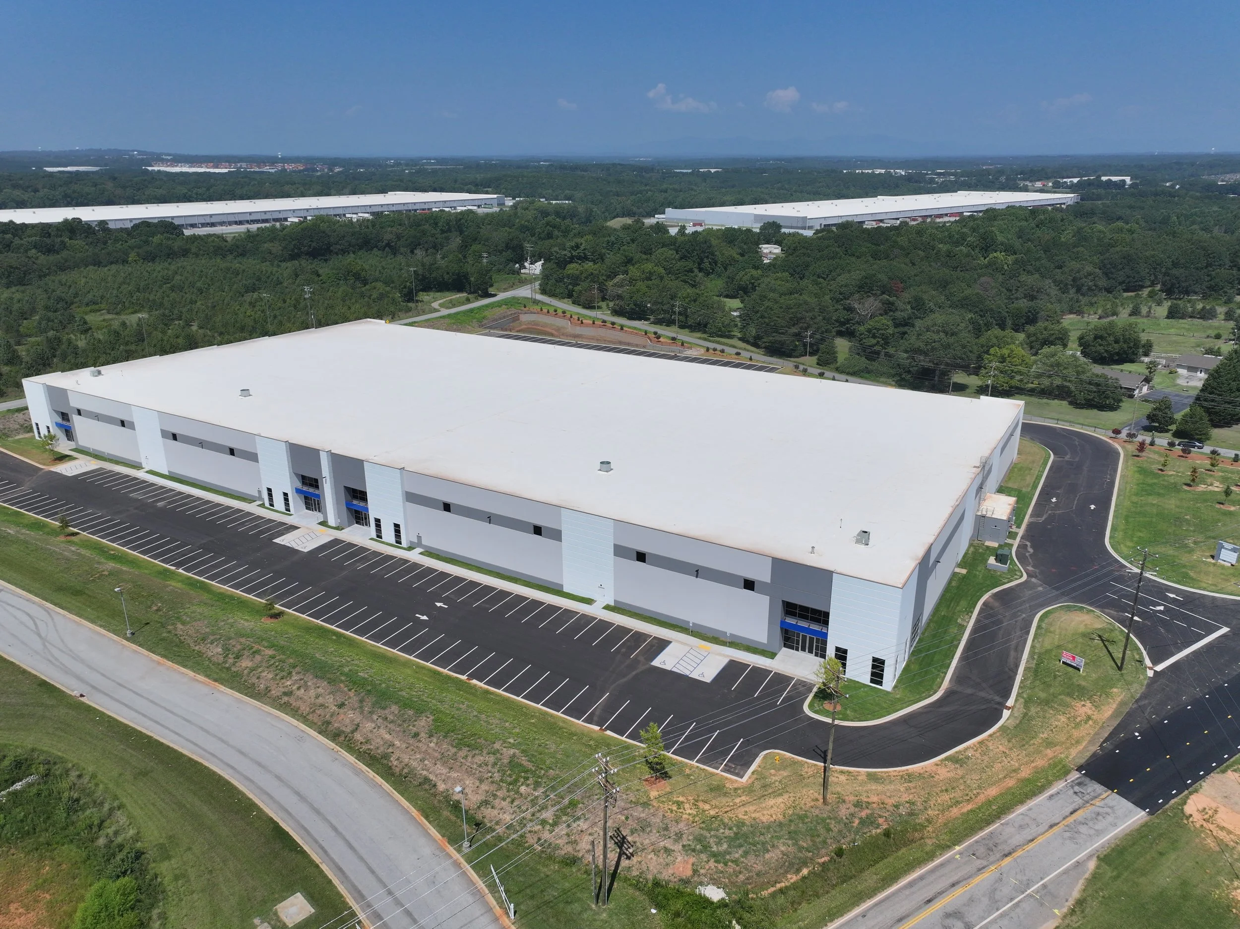
Warehouses & Industrial
Highlight loading areas, roof size, truck access, parking, circulation, industrial parks, and nearby transportation routes.
Hotels & Hospitality
Showcase the building, amenities, pools, outdoor areas, nearby attractions, road access, and surrounding commercial context.
Development Sites
Capture acreage, site clearing, grading, access, utilities, road frontage, nearby growth, and future-use potential.
Office & Medical Properties
Present parking, entrances, building visibility, landscaping, access, nearby services, and professional property condition.
Mixed-Use & Investment Property
Help investors understand property context, tenant spaces, traffic flow, surrounding development, and long-term opportunity.
Our Workflow
We keep the process simple so brokers, owners, and marketing teams receive polished, usable files without adding unnecessary complexity.
Review
We review the property, listing goals, access, airspace, nearby amenities, and the visuals needed for marketing or documentation.
Capture
We collect aerial photos, video, site overviews, drive-up shots, orbitals, and feature-focused imagery.
Edit
We prepare polished visuals with optional labels, music, branded overlays, property callouts, and social media edits.
Deliver
You receive organized files ready for listings, websites, brochures, social media, investor packets, and presentations.
Commercial Real Estate Deliverables
Deliverables can be simple or advanced depending on the listing, property type, and audience.
Marketing Deliverables
- High-resolution aerial photos
- Cinematic property video
- Short social media clips
- Branded listing visuals
- Parcel, road, and amenity callouts
- Raw footage plus edited final versions
Documentation Deliverables
- Orthomosaic maps
- 3D models when appropriate
- Roof and exterior documentation
- Construction progress records
- Before-and-after storm imagery
- Site condition and access visuals
Ready to Showcase a Commercial Property?
NC Drone Co can help commercial real estate professionals create professional aerial media, mapping, and site documentation that makes properties easier to market, understand, and evaluate.
Drones are revolutionizing commercial real estate by providing cost-effective, high-quality aerial imagery, video, and mapping solutions.
-
Aerial Photography/Videography:
Showcase properties with stunning aerial shots to highlight size, layout, and surroundings.
360-Degree Virtual Tours:
Create immersive property walkthroughs for remote buyers or tenants.
Highlight Key Features:
Highlight proximity to infrastructure, parking, landscaping, and other amenities.
-
Topographic Mapping:
Use drones for high-resolution 2D and 3D mapping of a site for better planning and design.
Site Inspections:
Quickly assess construction progress, maintenance needs, or environmental factors without needing a site visit.
-
Roof and Structural Inspections:
Drones can safely inspect hard-to-reach areas for wear, damage, or leaks.
Environmental Monitoring:
Track erosion, water management, and land changes over time.
-
Reduced Expenses:
Eliminates the need for helicopters, planes, or extensive manual labor for inspections.
Faster Turnaround:
Drones can collect data and produce outputs like maps or videos in hours, not days.


Commercial Warehouses