

Cell Tower Inspections
Drone-Based Cell Tower Inspection Services
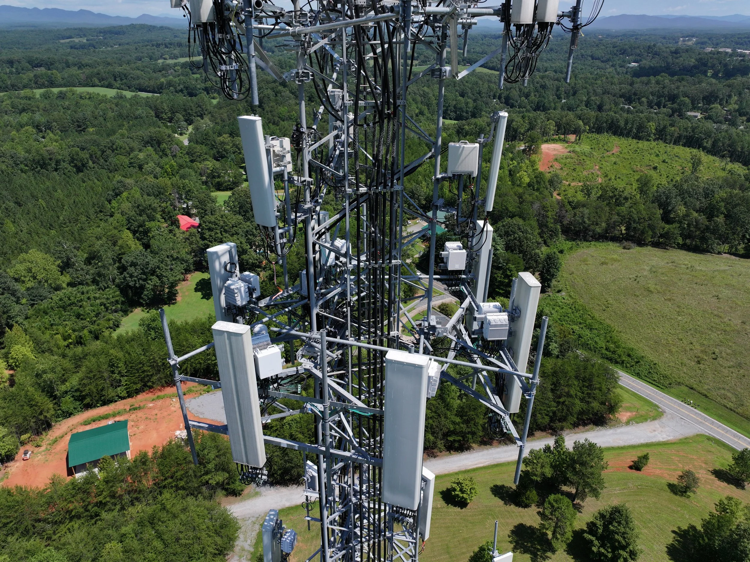
NC Drones LLC provides professional unmanned aircraft inspections for cell towers and telecommunications infrastructure. Our drone services help document towers, antennas, cables, mounts, and related equipment safely, efficiently, and with high-resolution aerial imagery.
Safer, Faster Tower Documentation
Drone inspections help reduce unnecessary climbing, limit downtime, and provide clear visual records for maintenance planning, storm response, and infrastructure review.
Safety First
Drones allow towers and elevated equipment to be inspected from a safer distance, reducing the need for technicians to climb during initial visual assessments.
Efficient Inspections
Aerial inspections can document tower conditions quickly while helping teams prioritize maintenance needs and reduce unnecessary site visits.
Clear Visual Records
High-resolution photos and video provide detailed views of antennas, mounting hardware, cables, structural components, and ground equipment.
Inspection Applications
Our drone services support telecommunications companies, tower owners, maintenance contractors, and infrastructure teams.
Structure & Hardware
- Visible corrosion or wear
- Loose or damaged components
- Mounting hardware visibility
- General tower condition documentation
Antenna & Cable Visibility
- Antenna position documentation
- Cable routing imagery
- Equipment layout review
- Multi-angle visual inspection support
Storm & Damage Response
- Post-storm aerial imagery
- Before-and-after documentation
- Rapid damage awareness
- Insurance and reporting support
Typical Inspection Workflow
Each project is planned around the site, tower type, access needs, airspace, weather, and the specific deliverables required by the client.
- Site review and flight planning
- FAA Part 107-compliant operations
- 360-degree orbit imagery
- Vertical scans and close visual passes
- High-resolution image collection
- Organized delivery of photos, video, and findings
Available Deliverables
Photo Sets
Organized high-resolution photos documenting tower components, antennas, mounts, cables, and site conditions.
Video Documentation
Smooth aerial video can be captured to provide additional context for visual review and project records.
Thermal Support
Thermal imagery may be available when appropriate for identifying heat-related concerns or equipment irregularities.
Inspection Summary
Deliverables can be packaged for maintenance teams, asset managers, insurance documentation, or internal reporting.
Need Cell Tower Inspection Support?
NC Drones LLC provides professional drone inspection services for cell towers, telecommunications assets, and related infrastructure throughout North Carolina and surrounding regions.
Schedule a Call