Multispectral Analysis
Multispectral analysis using unmanned aircraft systems (UAS), or drones, involves capturing data across multiple wavelengths of light, including those beyond the visible spectrum (e.g., ultraviolet, infrared, and near-infrared). Multispectral sensors on drones enable the collection of data that can provide insights about the health, condition, and characteristics of environments or objects that would otherwise be invisible to the naked eye.

By equipping drones with multispectral sensors, industries can gather rich data to optimize operations, improve decision-making, and address environmental challenges. This technology continues to grow in importance as drones become more advanced and affordable.
-
Sensors:
Multispectral cameras are mounted on drones. These sensors capture light in specific bands (e.g., red, green, blue, near-infrared, or thermal infrared). Each band provides unique information about a target's properties.Data Collection:
The drone flies over an area, collecting reflectance data in each spectral band. Different materials (e.g., soil, vegetation, water, buildings) reflect or absorb light differently depending on their composition or condition.Processing:
The data collected is processed using specialized software to create maps or models, such as vegetation health indices (e.g., NDVI – Normalized Difference Vegetation Index) or thermal maps.Analysis:
The processed data is analyzed to extract actionable insights. Analysts interpret differences in reflectance to identify patterns, changes, or anomalies.
-
Agriculture:
Crop Health Monitoring: Detect early signs of stress, pests, or disease before they are visible to the human eye.
Irrigation Management: Identify overwatered or underwatered areas.
Yield Prediction: Assess plant growth and predict yields based on spectral analysis.
Forestry:
Monitor forest health and identify tree diseases.
Map deforestation and reforestation efforts.
Track species diversity or biomass changes.
Environmental Monitoring:
Analyze water quality by detecting algal blooms or pollution.
Track changes in wetlands, deserts, or other sensitive ecosystems.
Monitor soil erosion or degradation.
Infrastructure Inspections:
Detect heat leaks or faults in power lines using thermal and multispectral sensors.
Assess the condition of roofs, roads, or other structures.
Disaster Response and Recovery:
Assess damage after floods, fires, or other disasters.
Map hazardous zones or monitor recovery progress.
Mining and Geology:
Map mineral distributions based on their spectral reflectance.
Monitor the environmental impact of mining operations.
-
Cost-Effective: Drones can cover large areas quickly, reducing the need for expensive manned aircraft or satellite imagery.
High Resolution: Drone-based sensors often provide much higher spatial resolution than satellites.
Real-Time Insights: Data can be collected and processed rapidly, allowing for timely decision-making.
Flexible Deployment: Drones can access hard-to-reach or dangerous areas, such as remote forests, volcanoes, or disaster zones.

Specifications:
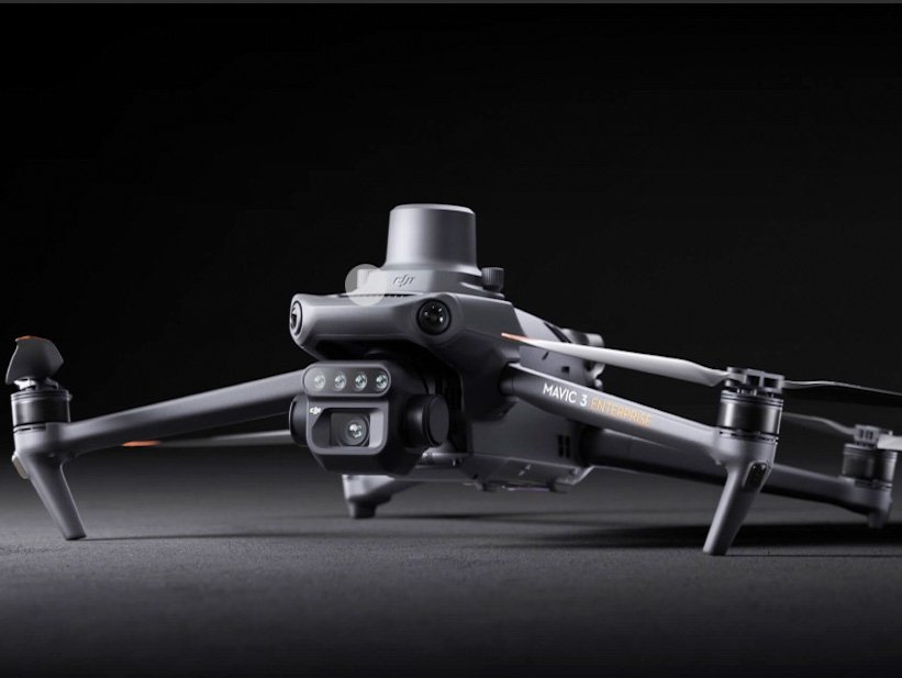
DJI Mavic 3 Multispectral
20MP 4/3 CMOS RGB camera
Four 5MP multispectral cameras
Sunlight sensor
RTK module for centimeter-level positioning
43-minute max flight time
200-hectare coverage in one flight
O3 transmission up to 15km
Contact us.
Contact@ncdroneco.com