Market Raw Land with Aerial Drone Imagery
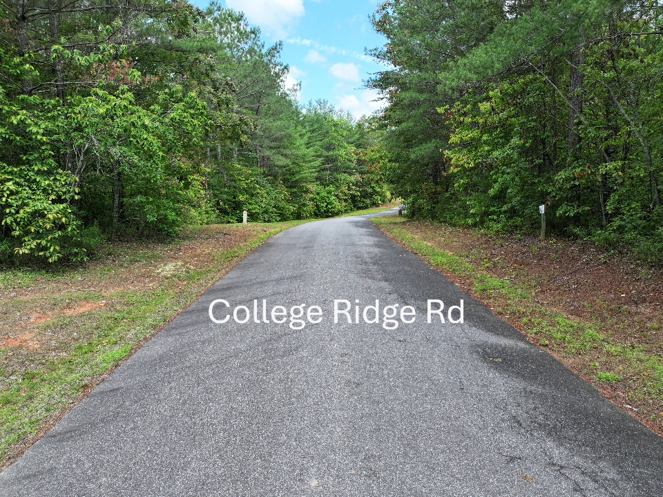
Drones are a great tool to show raw land for real estate. Clear aerial photos and videos give wide views, show important details like roads, land shape, and nearby landmarks, helping buyers understand the size and layout. For listings, ads, or virtual tours, drone images attract attention and boost interest, helping land sell quicker and for more money.
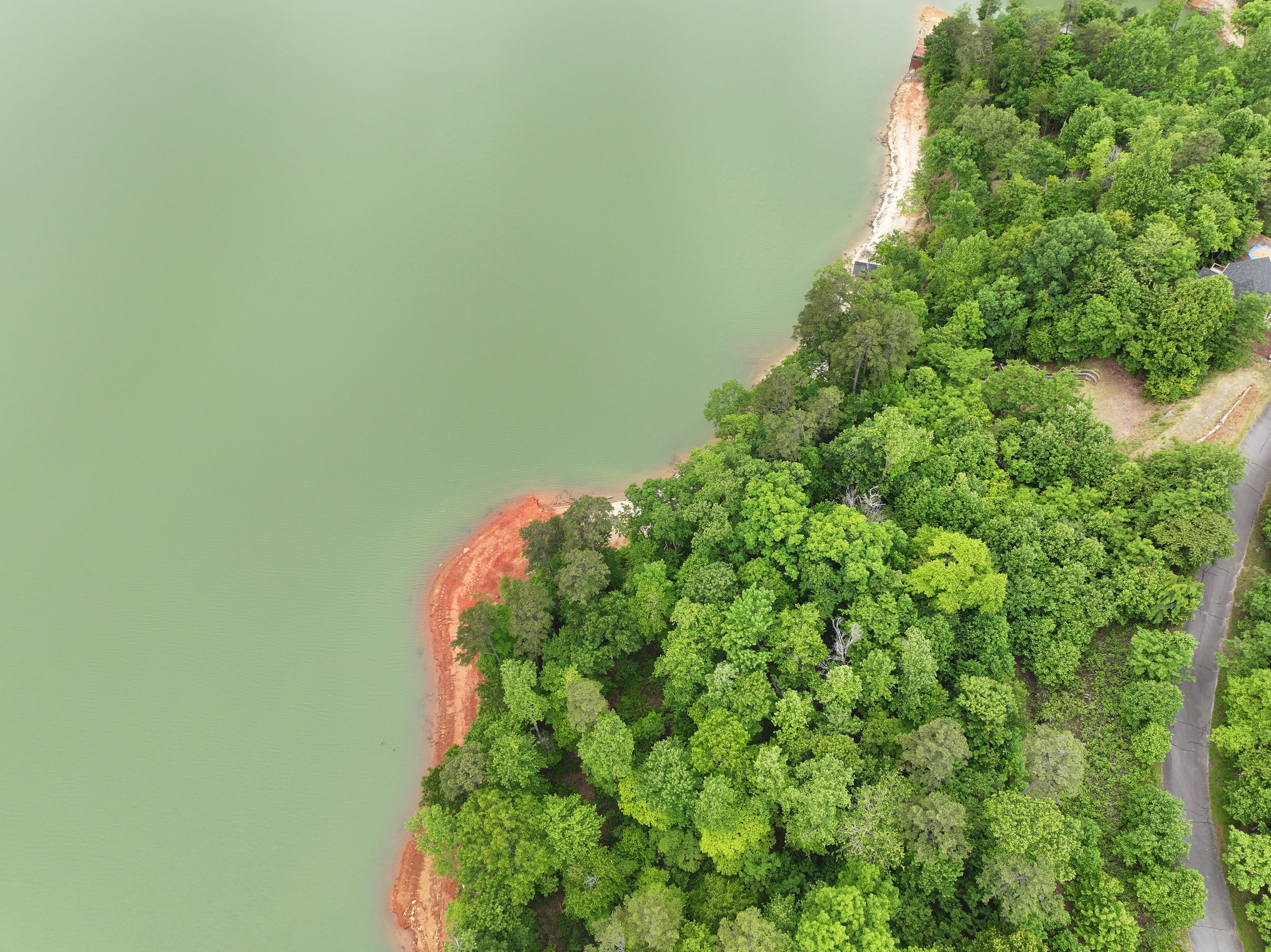
Raw Land in Lake Lure, NC
Using drones to capture footage of raw land for residential real estate provides a dynamic and cost-effective way to showcase property to potential buyers. Aerial imagery and video offer a comprehensive perspective of the land’s topography, boundaries, access points, surrounding infrastructure, and natural features.


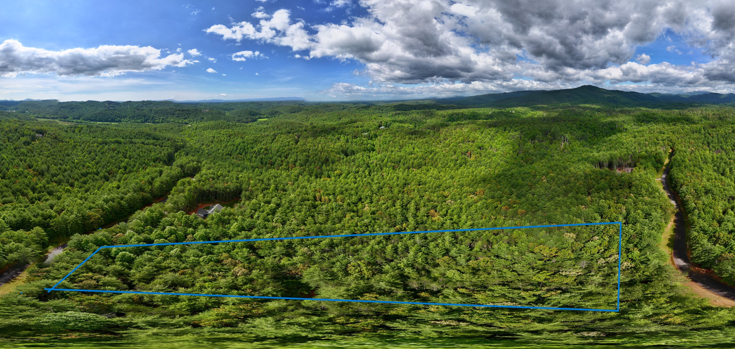
Take an aerial tour of this incredible piece of raw land nestled in the heart of the Blue Ridge Mountains near Marshall, NC. We recently completed a drone shoot to highlight the natural beauty, flat terrain, and endless potential of this mountain property.
Surrounded by peaceful scenery, mature trees, and wide-open skies, this property offers the perfect blend of seclusion and accessibility.
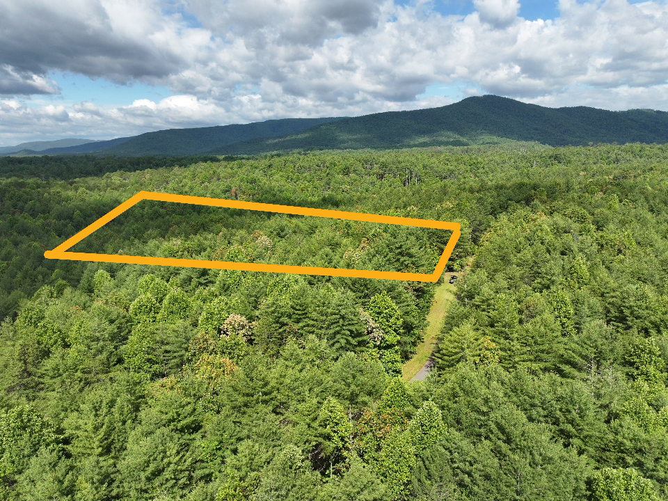
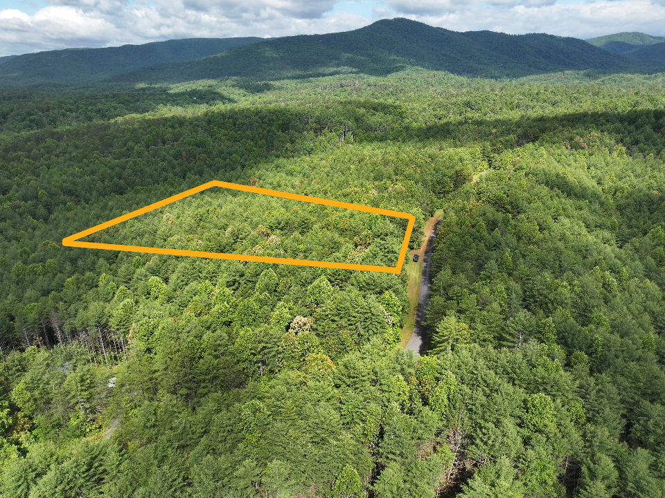
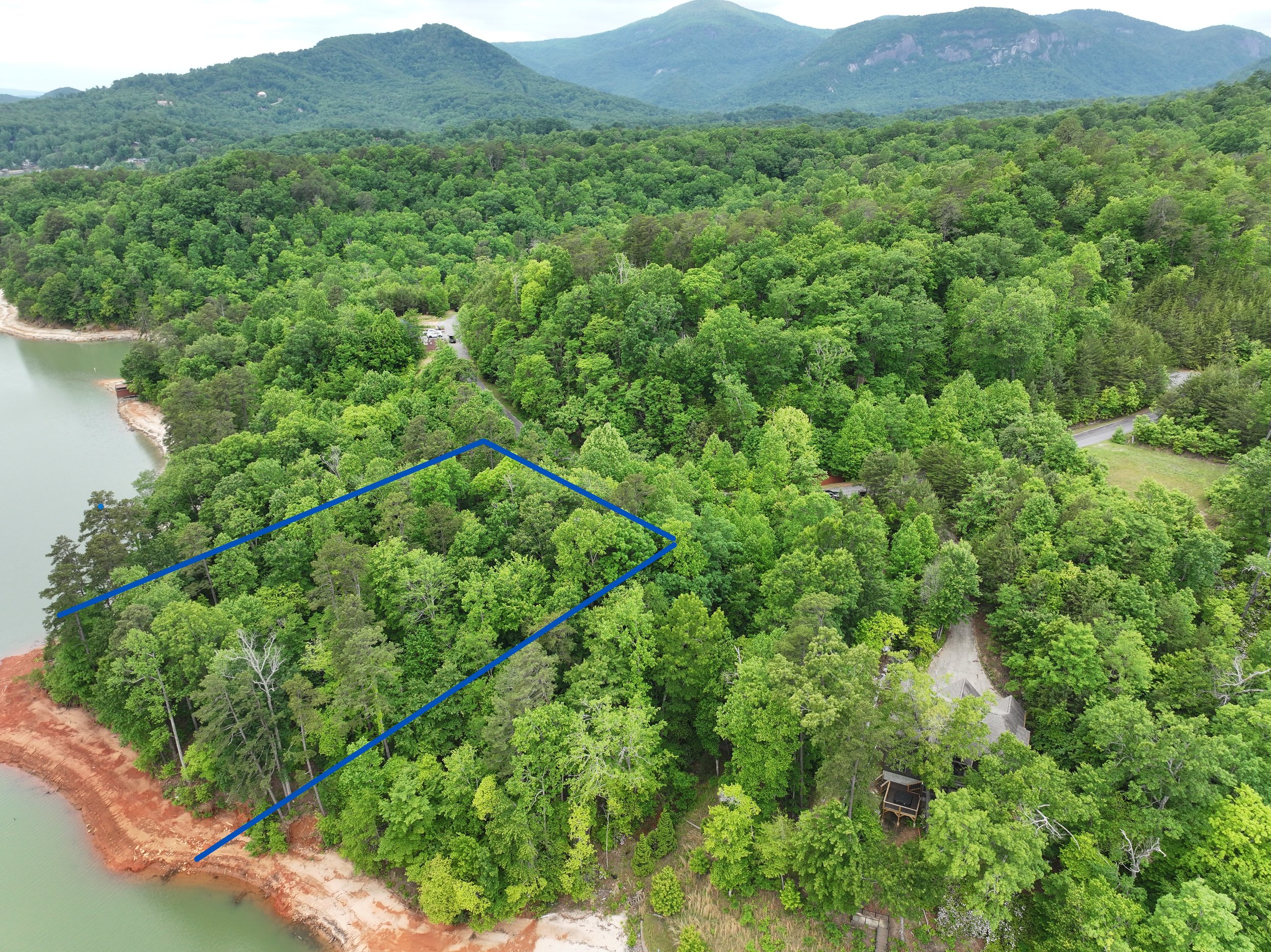
Raw Land: Landrum, SC
Captured stunning aerial visuals of a prime commercial property to help our real estate partners market with impact. High-resolution photos, dynamic video, and detailed overviews — all tailored to showcase value from the sky.
Raw Land at the Cliffs in Landrum, SC
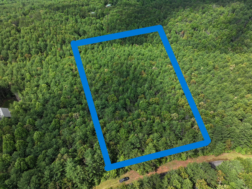
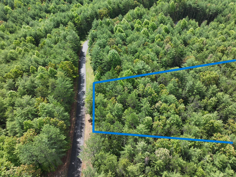
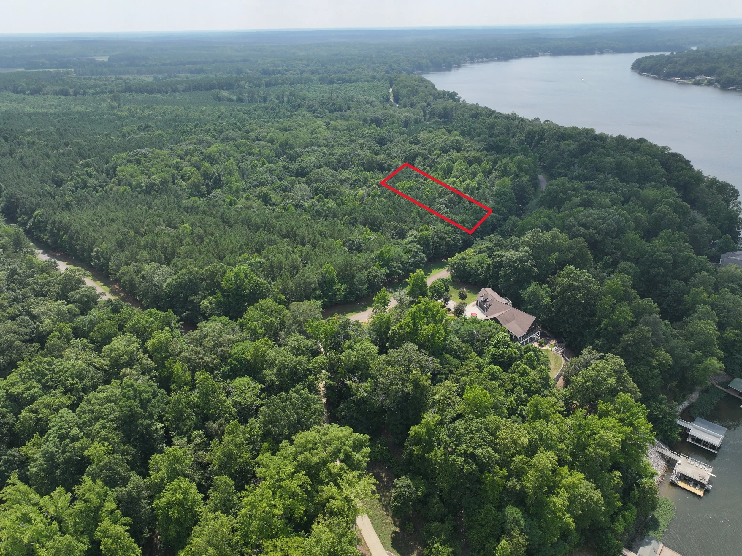
Raw Land: Caldwell County, NC
Using high-resolution drone footage, we captured sweeping views of the property to showcase its full potential — from scenic surroundings to access points and topography. Perfect for real estate listings, investor presentations, and online marketing campaigns.
🎥 Shot with: DJI Mavic 3 Pro
📸 Services: Aerial photos + cinematic video
📊 Purpose: Boost visibility & attract buyers